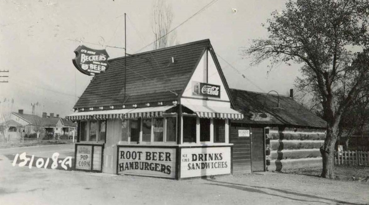
It’s Summer Time: Lunch Stand Flashback
To celebrate the first day of spring (March 1, “meteorological spring”), we bring you an image from 1949 of a lunch stand. The “White Spot” lunch stand was located at 3325 South 900 East.

More images of lunch stands to come, along with (hopefully) more lunch stand weather for Salt Lake County!

The image above was taken by the Salt Lake County tax assessor in 1936. “Schraven Terrace,” as this uniquely shaped building was named, was constructed in 1905 and located at 623 – 627 West 100 South in Salt Lake City. Below is a plot plan drawing showing the outline and dimensions of this terrace building in 1936.

Source of images: Salt Lake County Tax Appraisal Cards and Photographs, parcel 15-01-107-007, serial 03-1562. Salt Lake County Archives.
A few views of Copperfield in Upper Bingham Canyon as it existed in 1938. As many of our readers already know, this specific area is located west of Salt Lake City and is now the site of the world’s largest open-pit copper mine. All photographs were taken by the Salt Lake County Assessor. These and thousands more photographs and documentation of Salt Lake County buildings can be found at the Salt Lake County Archives.


This gas station was located at 4126 South Redwood Road when this photograph was taken in 1961. It epitomized how gas station architecture had at one time been greatly inspired by the space-age. The uniquely shaped canopy not only made this building very noticeable to drivers/potential customers, but reflected the popular interest in technology and aeronautics at the time. Even the tall lights appear to be ready to take off and fly away in to the sky.

A work of art in its own right, this plot plan of the Regal gas station was drawn by the tax assessor in 1961 and shows the high-tech angles of this building.
Images from the Salt Lake County Tax Appraisal Cards and Photographs, serial 24B-351.


These lost houses were located in Bingham Canyon, in the Oquirrh Mountain range on the west side of the Salt Lake Valley. Copperfield was one of the towns that existed in the canyon that has since been overtaken by the copper mine. This photograph was taken in 1938 by the Salt Lake County Assessor.

In this image taken in 1934, a little boy is waiting for his cycling companion to come out of C.W. Brady’s Red and White store, located at 3301 South 2300 East. (Click on the image to see all of the details). What does this location look like today?


Many of you may already be familiar with this truly “lost house.” Formerly located at 180 East South Temple in Salt Lake City, this house was supposedly designed by Truman O. Angell, the architect of the LDS Church’s Salt Lake City Temple. Brigham Young had this house built for one of his wives, Ann Eliza Webb. When she later divorced him, Brigham Young’s daughter Ella and her husband Nelson A. Empey moved in to this house. After Ella Young Empey died in 1890, Nelson A. Empey married Emma Adams. Emma and family lived in this house until the late 1940s.
The house was dismantled in 1953. The book Brigham Young’s Homes (edited by Colleen Whitley) notes that the house had been given to the Sons of Utah Pioneers. They wished to move it to the new Pioneer Village that had been planned to take over the site of the old Utah State Prison. The pieces of the building were moved to storage on Horace Sorenson’s property. However, when the prison site did not work out, this house was left behind when the buildings were sold to Lagoon to form what is now known as the Pioneer Village.
Among many of the unique architectural details in this house, the diamond-shaped window contained a stained glass representation of a beehive. This window had been used in the Utah building at the Chicago World’s Fair. The chimneys were also built in an octagonal shape to imitate a cell in a beehive.


In 1965, a ZCMI tires and auto accessories store was built on the location formerly occupied by the Empey Cottage. This building still exists today as an auto service center.

Check out an earlier image of this house, and an image from another angle, both in the custody of the Utah State Historical Society.
